Trail Adventure
Step 1: Access Points
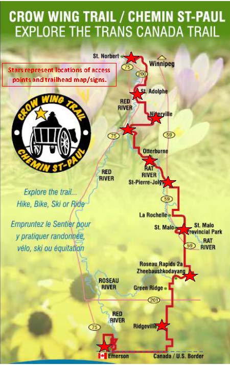
Where do you want to start? There are 10 access points along the 193 km of Trail.
- Red River Floodway – via PR 200 GPS: Latitude 49.757598, Longitude -97.117542
- St. Adolphe – Old Community Park – via PR 200 GPS: Latitude 49.672263, Longitude -97.114253
- Niverville – Hespeler Park – via PR 311 GPS: Latitude 49.596655, Longitude -97.041039
- Mennonite Landing – via PR 200 GPS: Latitude 49.587956, Longitude -97.136245
- Otterburne – Post Office – via PTH 59 and PR 303 GPS: Latitude 49.496383, Longitude -97.051344
- St-Pierre-Jolys – Museum – via PTH 59 GPS: Latitude 49.442286, Longitude -96.986886
- St. Malo – Grotto Entrance – via PTH 59 GPS: Latitude 49.316751, Longitude -96.947680
- Senkiw – Suspension Bridge – via PTH 59 or PR 218 GPS: Latitude 49.196776, Longitude -96.887182
- Ridgeville – Community Park – via PR 218 GPS: Latitude 49.066605, Longitude -97.010692
- Emerson – Community Park – via PR 200 GPS: Latitude 49.002759, Longitude -97.219277
Each access point is identified by
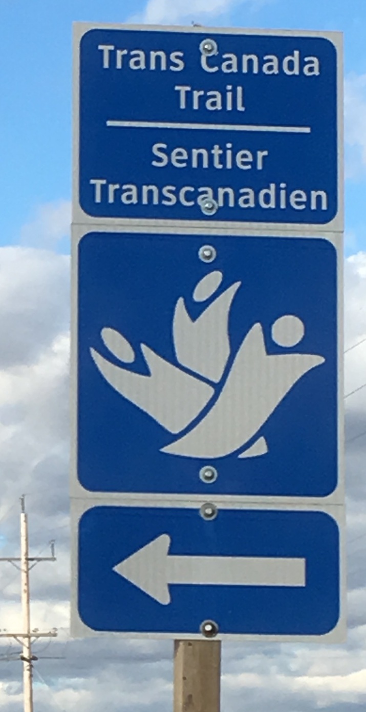
- Blue Trans Canada Trail/Sentier transcanadien signs on provincial roads
- Access Point Signs
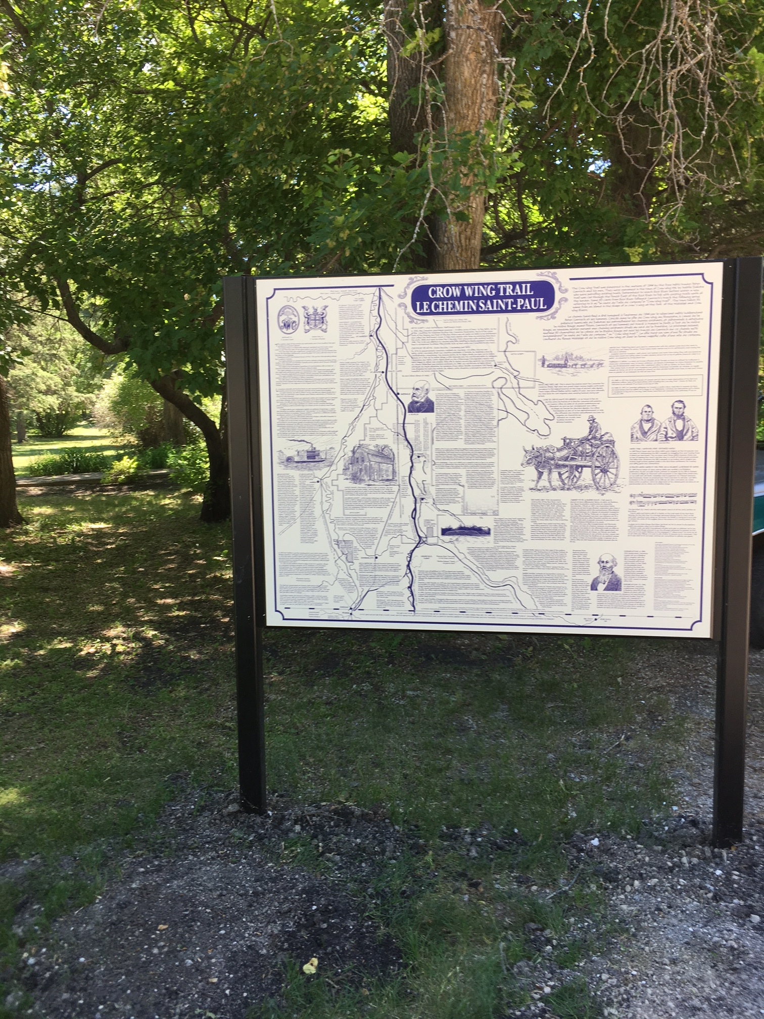
- Trailhead Signs, with historical and modern maps, have been installed at 7 sites. Coming soon: St. Malo, Otterburne and Niverville.